‘Indy’s oldest tech startup’ gets a new name and a new space
The Schneider Corporation is a 56-year-old Indianapolis-based company run by third-generation siblings Victoria Schneider Temple (CEO) and Barry Schneider (chairman) and located on Otis Avenue in the historic Fort Benjamin Harrison community on the Northeast side of the city.
Hiding within the company’s long and storied history, until now, is also the origin story of a highly successful software startup that has many of the same hallmarks as some of today’s best-known tech companies.
The company pivoted to geographic information systems (GIS) and software development while most providers were still operating on paper-based systems, and the tech division began growing in its own markets — both organically and through acquisition — independently of Schneider’s traditional survey and engineering division, which is now known as Schneider Geomatics with Scott Stephens as its president.
“We’re kind of the oldest startup in history,” said Jeff Corns, president of Schneider Geospatial, the new spinoff name of Schneider Corporation’s GIS and e-Government businesses, which employ nearly 50 people. “We wanted to keep the Schneider name because there’s a lot of great brand recognition there for us as a family-owned services business that stands for quality, but we also wanted to lean into where the industry is going — which is actually representative of where we have led the industry in terms of technology application and innovation.”
Schneider Geospatial pioneered the development and use of new e-government solutions for small and medium size communities. The two-time “best of tech” Mira Award winner leveraged a deep understanding of local government organizations and advancements in technology to launch a software-as-a-service (SaaS) e-government suite that changed the way both the local governments and their constituents interacted with each other. Gone are the traditional limitations; lines, hours of operation, undefined workflows, bottlenecks in communication. These have been replaced with solutions that are available 24 hours a day, every day, from wherever the end user is.
What sets Schneider Geospatial apart from other tech companies in the space is that they don’t require communities to switch software or do anything differently than they are already doing in order to take advantage of Schneider’s platforms that enable aforementioned tech advancements.
“Instead of making the counties or municipalities switch to something new or change their service models, our software developers have created hundreds of integrations and simplified the onboarding for them so they can focus on serving the public and we make maintaining the data an automated process through more than 2,000 scheduled data pulls every night,” said Jeff.
For example, Schneider Geospatial started working with a new customer just last year, St. John’s County which encompasses the city of St. Augustine in Florida and lays claim to being the oldest city in the U.S. By rolling out its e-Government platforms and checking the data analytics in real time, Jeff demonstrated how the county was able to save 2.1 million hours of would-be face-to-face government services now provided online (the way most people want it), which translates to more than $15 million in savings while at the same time freeing up government staff to handle backlogs and other services that provide overall improved experiences and significantly higher return on the taxpayer dollar. It’s worth noting as well, that this data wasn’t even a full year since implementation.
Over the past five years, as Scheider Geospatial has grown by triple-digits annually to become one of the largest e-Government providers in the country with nearly 20 percent market share and launched new products — eleven e-Government platforms in total including its flagship BeaconTM and qPublic.netTM products — it became clear to management that its two distinct divisions would need their own accounting and HR functions to meet the needs of their unique markets and sales and marketing efforts.
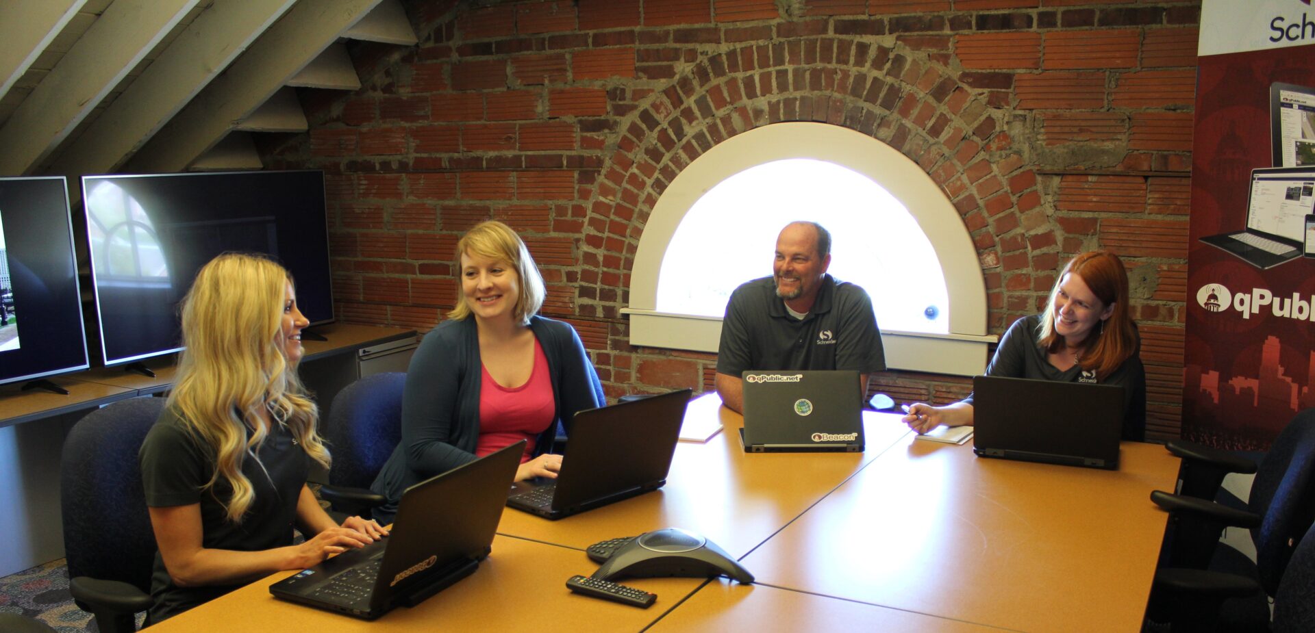
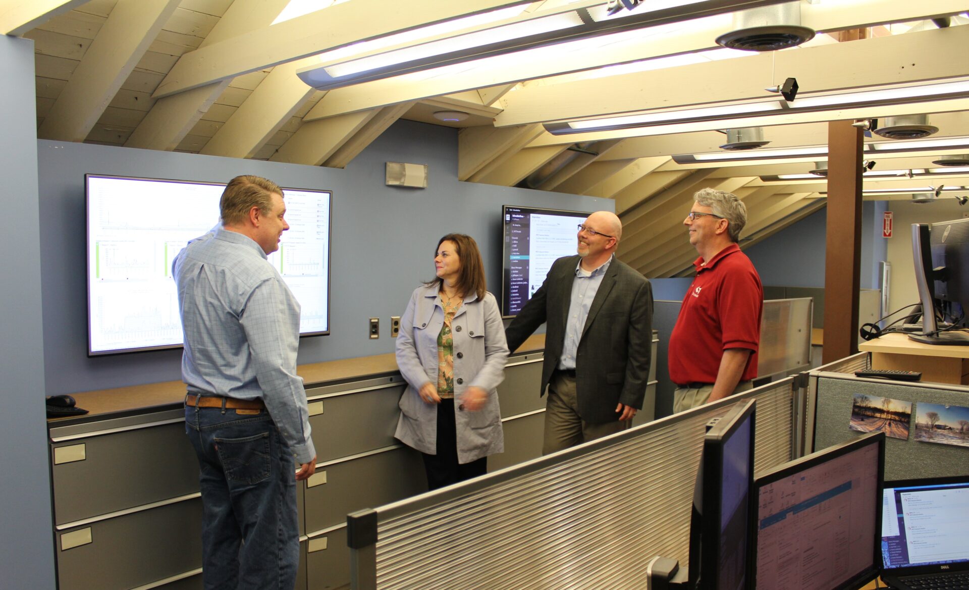
Schneider Geospatial technically spun out of the parent company effective January 1, and recently moved into their renovated new headquarters on the third floor of the same historic army barracks that is home to Schneider Geomatics and The Schneider Corporation, and employ about 120 people.
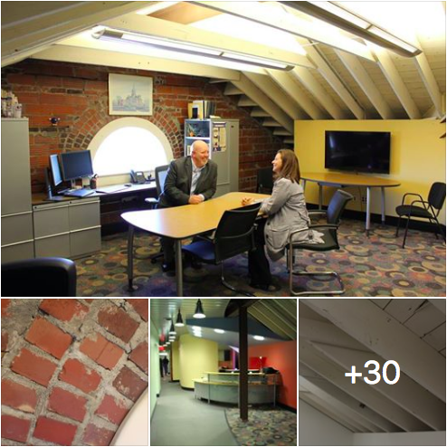
I recently toured and photographed the new space, which can be viewed on Facebook in a special Schneider Geospatial office tour photo gallery.
“As Schneider Geospatial grew to 40 percent of the company revenue, we recognized that we were really a different company, a software product company with all of the same trappings of other tech companies,” Jeff said.
“We addressed the backend needs with the spinout and establishing our own HR and accounting and other infrastructure, but moving into the new space is probably one of the biggest advantages we can all feel and take pride in. Quite frankly, the space is just so cool and interesting and something that really matters to top tech talent — that’s including our current team who built and brought us here, and the new hires we’ll be recruiting to continue to innovate and grow market share.”
The exposed brick, painted rafters and light-flooded space certainly isn’t what anyone would expect from a company founded in the early 1960s. It’s more akin to the start-up and scale-up spaces seen in Manhattan loft-style offices and downtown Indy towers.
You can read more about The Schneider Corporation and its new Schneider Geospatial spinoff company in our 2017 profile and its Mira Award winner stories at TechPoint Index.